
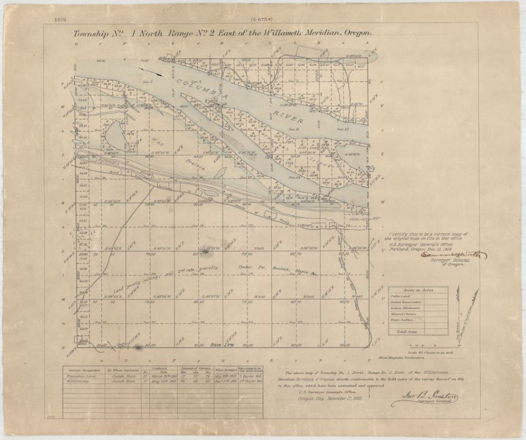
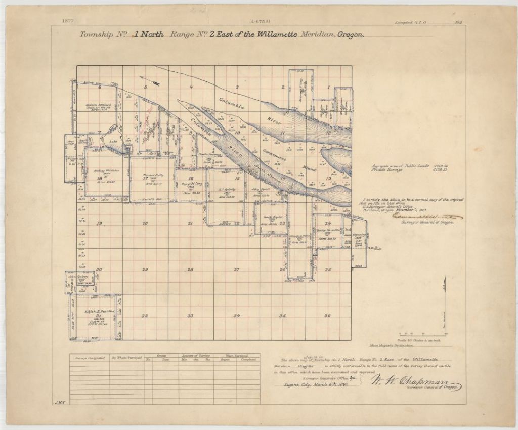
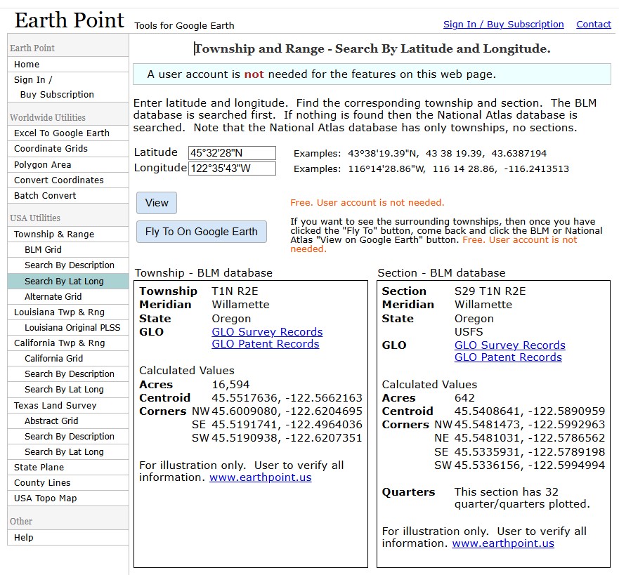
Though we covered this six years ago, we thought it might be worthwhile to revisit the topic. In 1855, what we now call the Rose City Bluff would have been just recently determined by survey to be in Section 29, Township 1 North, Range 2 East. The Section, Township, and Range (STR) system for surveying and documenting land ownership begins at a designated starting point from which a baseline runs east-west, and a meridian runs north-south. Townships are square, six by six miles, north or south of the baseline, and east or west of the meridian. They are divided into thirty-six sections, each of which is one mile square or 640 acres (more or less). We can determine the section, township, and range from latitude and longitude positions with this Earthpoint tool.
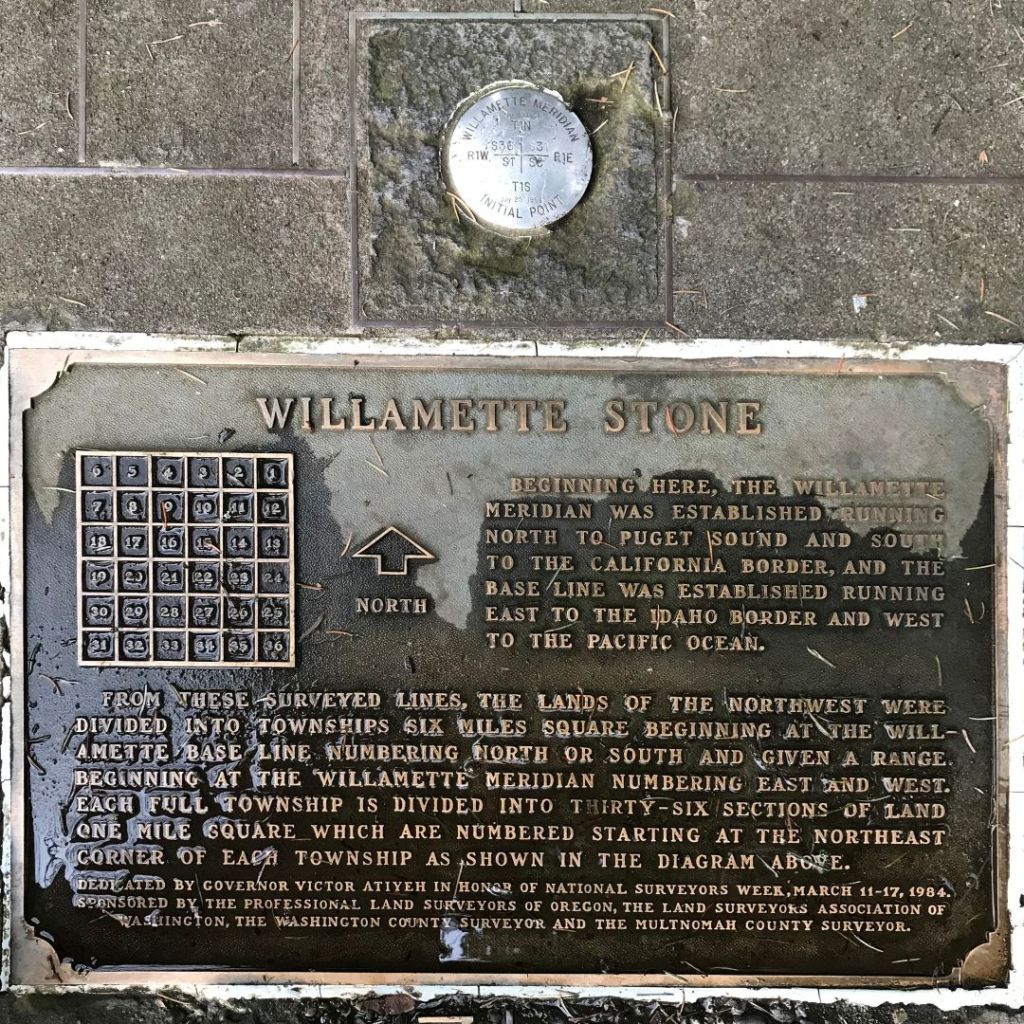
The designated starting point for the Oregon and Washington STR system may be found at the Willamette Stone State Heritage Site on Skyline Drive in West Portland. The original point was marked by a cedar stake placed by the Surveyor General of the Oregon Territory in 1851. The east-west baseline became Base Line Road, later renamed Stark Street. SE Division Street in Portland (formerly Section Line Road) follows the division between the first and second rows of the sections south of the baseline. NE Tillamook Street follows the first and second rows of sections north of the baseline.
The need for the STR system was precipitated by the Donation Land Act of 1850, offering 320 acres of free land to white male settlers (640 for married couples) who arrived by a deadline, lived on, and cultivated the land for four years. This significantly boosted migration but also displaced Native Americans.
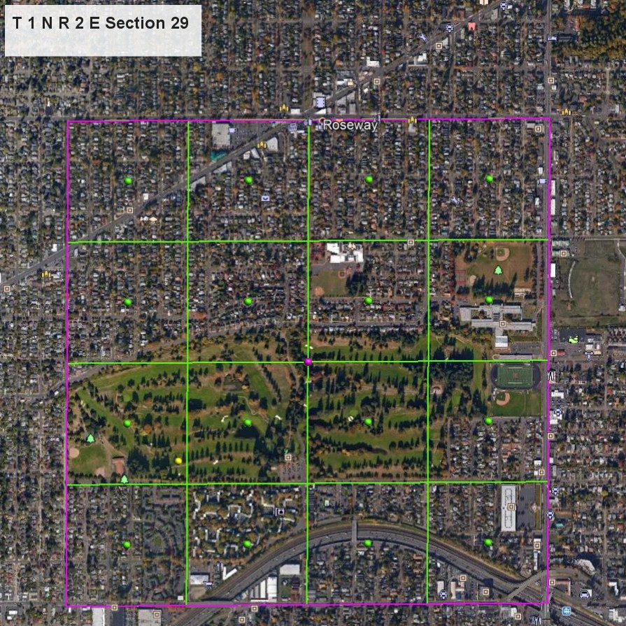
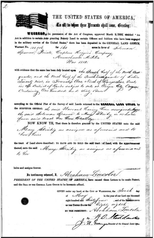
The Donation Land Act established a system whereby veterans of the Revolutionary War and the War of 1812, along with their heirs, were granted land by the U.S. government through Bounty Land Warrants to encourage enlistment and reward service, with the practice continuing until 1855. Veterans who received bounty land warrants but didn’t want to settle on the land sold these warrants or assigned their rights to land speculators or settlers, who then used the warrants to claim land in Oregon, effectively transferring ownership to actual settlers who fulfilled the residency requirement that they live on and cultivate the land. One such warrant granted 160 acres of Section 29, T1N, R2E to a veteran of the War of 1812, Soloman Sparrow, who assigned it to Mary Streibig (b. 1832, d. 1897). This land now includes the back nine of the golf course, Glenhaven Park, and McDaniel High. A plat map of the T1N, R2E township from 1929 describes this land as “. . .2nd rate, gravelly. . .”
The land occupied by the Rose City Golf Course was acquired under two separate acquisitions. The first one pertained to land west of NE 72nd Ave. between NE Sacramento St. and NE Tillamook St. and is described in the deed to the City of Portland as the N 1/2 of the SW 1/4 of Section 29, T1N, R2E, lying south of the center line of NE Sacramento St, formerly Hillcrest Drive.
Under the Donation Land Act, over 7,000 settlers acquired more than 2.5 million acres of land, especially in the Willamette Valley. Wives could hold their half of the land in their own name. The act excluded non-whites and treated tribal lands as vacant, accelerating the dispossession of Native peoples. Oregon history continued to be fraught with racial equality issues for at least the next 150 years.
Please check out a few more photos for this post at our website.

Love the “Land gently rolling and second rate gravelly”. Thanks for pulling this all together. Cheers!
LikeLike